Drone survey software for construction and quarries, measured in a browser
Clarity turns a drone flight into numbers somebody can answer for: stockpile volumes with the base printed beside them, cut and fill against the design, contours and cross-sections, and month-to-month progress with every flight of the site on one timeline. Bring the GeoTIFFs you already have, or send us the raw photos.
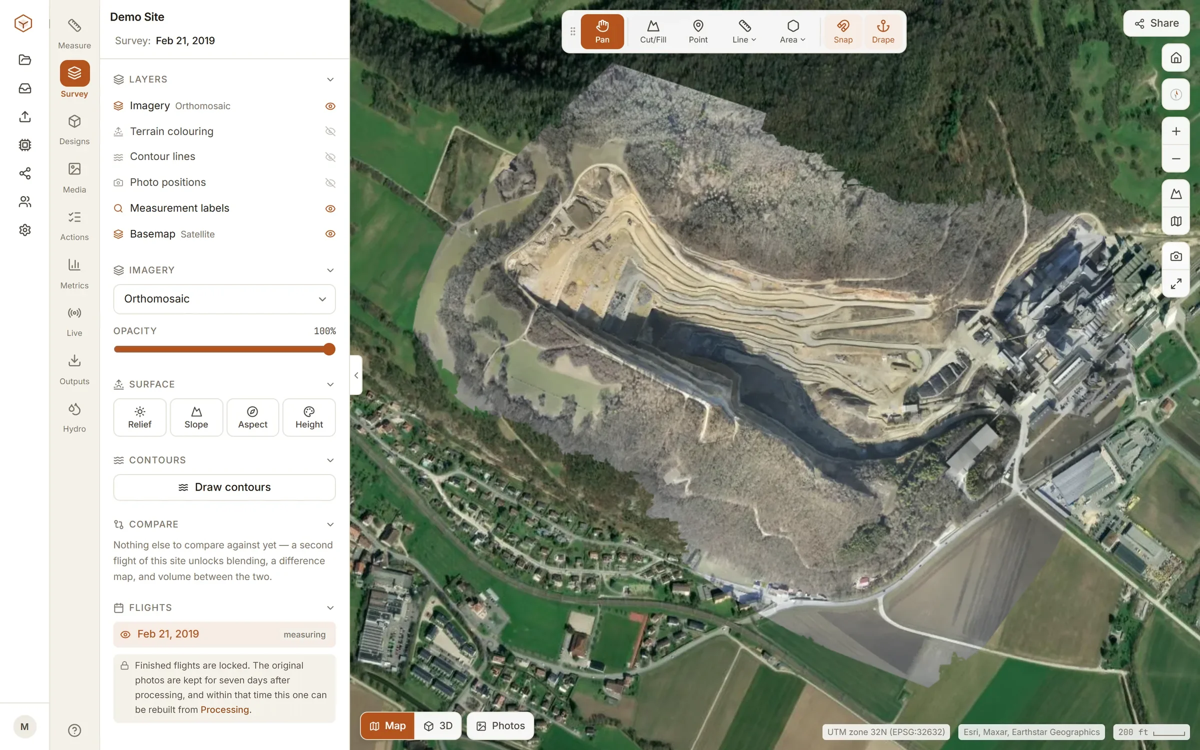
From a flight to a figure, with its working shown
Built for the surveyor, the estimator and the quarry manager who have to defend the number, not for a dashboard.
Stockpile volumes you can defend
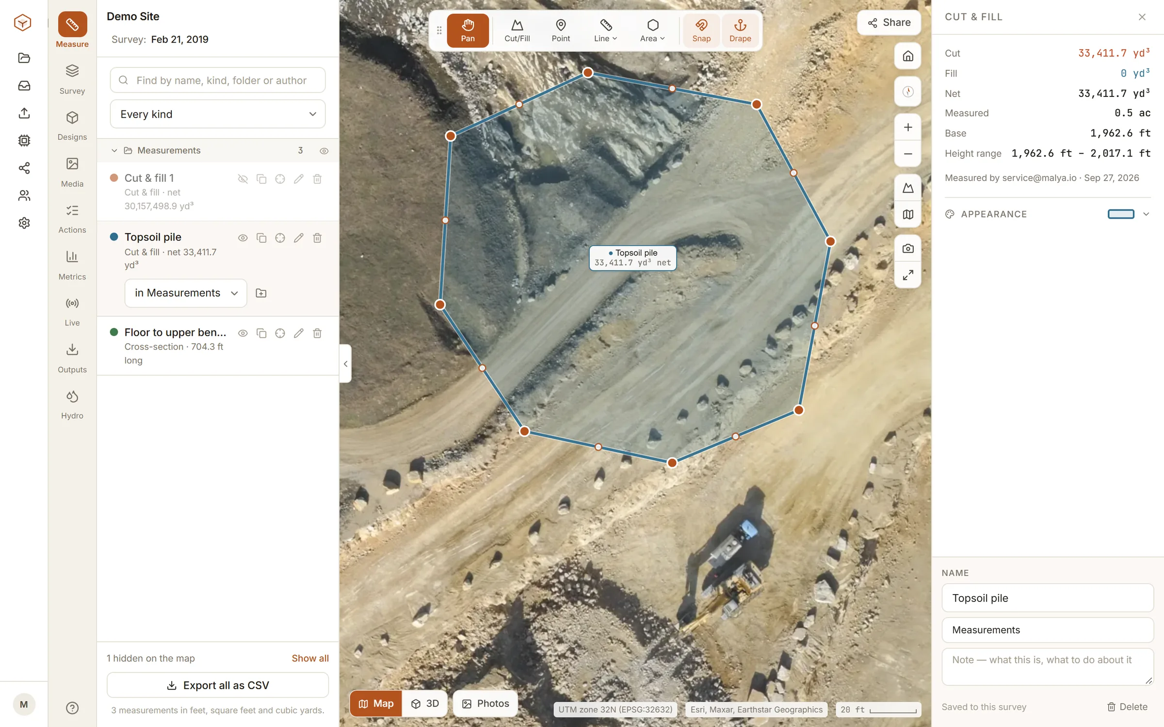
Draw the boundary, pick the base — a fitted plane, the lowest point, a fixed level, an earlier flight or a design surface — and the volume is printed with the base it assumed, the area it measured and the tonnage at your density.
Cut and fill against the design
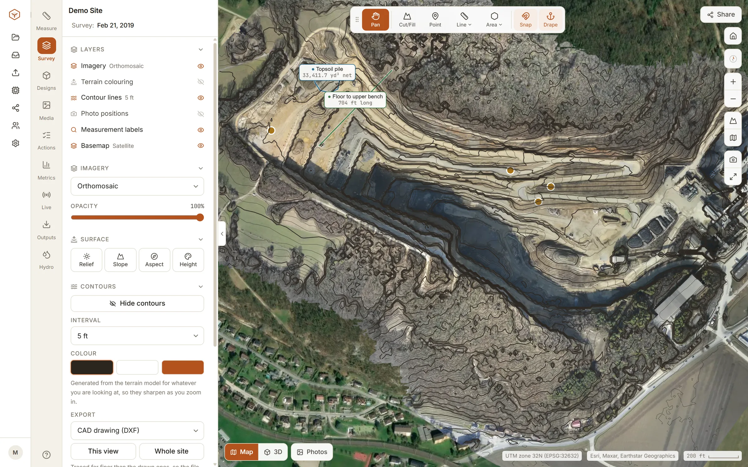
Bring the engineer’s LandXML or DXF surface and read cut, fill and net over the whole site or inside any boundary, with a deadband so survey noise is not counted as earthwork. Cross-sections and contours come off the same terrain model.
Every flight on one timeline
Upload the new flight and it takes its place beside the last. Swipe between dates, difference them into a map of where the ground rose and fell, and level two flights on ground that did not change when they sit apart.
Your GeoTIFFs, or your raw photos
Studio takes the orthomosaic and elevation models you already processed, from any software. Enterprise takes the raw drone photos and returns the orthomosaic, DSM, DTM, point cloud and mesh, with ground control and PPK handled on the way.
On a real quarry
The demo site in every free account: a working quarry, flown and processed, with every tool live on it.
Who Clarity is for
Quarries and aggregate yards
Month-end stockpile inventory with the base, the density and the tonnage recorded, and last month a click away for the auditor.
Earthworks and civil contractors
Cut and fill against the design each month, progress between flights, and the figures a valuation or a claim is built on.
Survey crews and drone operators
A browser home for the orthomosaics you already produce, with measurements and share links for the client, priced per site rather than per seat.
Three plans, said plainly
The full plan table is on the product site.
Explore
Studio
Enterprise
Malya Clarity — Frequently Asked Questions
The answers below are the same text Google sees in our FAQ schema.
Measure something before you pay for anything
The quickest way to judge survey software is to measure a stockpile in it. The demo quarry is waiting in every free account.